Legacy: MAPS
Legacy features a number of locations around the globe, including South East Asia, the Indian subcontinent, Java, Britain, Ireland, France, Italy, Greece, Egypt and ultimately Australia, following the rich and varied life of William Light , his mother and his siblings.
I have included a variety of maps below reflecting the period in which the action takes place. I’m always on the look out for better ones- exact maps are notoriously difficult to source– so please feel free to share any relevant maps and I will be delighted to add them!
Part One: Prince of Wales Island
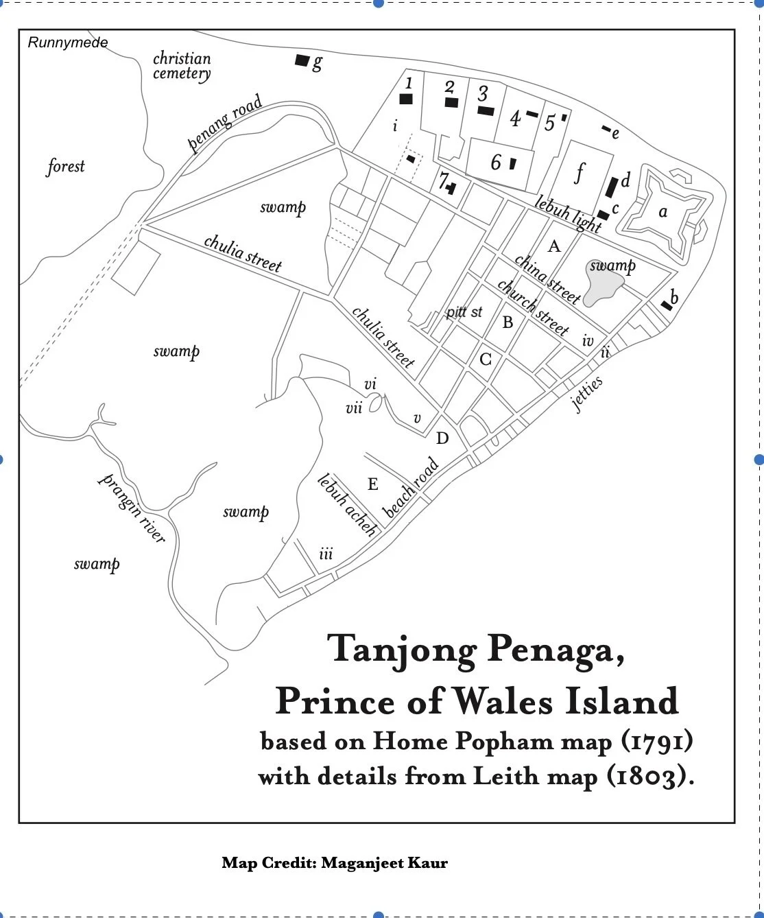
RESIDENCES
1. Martinha’s 2. Government House 3. Grays
4. Macalister 5. Officer quarters 6. James Scott
7. Dr Howison
THE SETTLEMENT
A. Chinatown. B. Eurasian quarter C. Chulia quarter
D. Malay Town E. Aceh quarter
THE FORT
a. Fort Cornwallis b. Custom House c. Guardhouse
d. Military Hospital e. Guesthouse f. Barracks
g. General Hospital
AMENITIES
i. Well ii. Warehouse iii. Kiln iv. Catholic church
v. Kapitan Keling Mosque vi. Malay mosque
vii. Muslim cemetery
Part Two: The East Indies
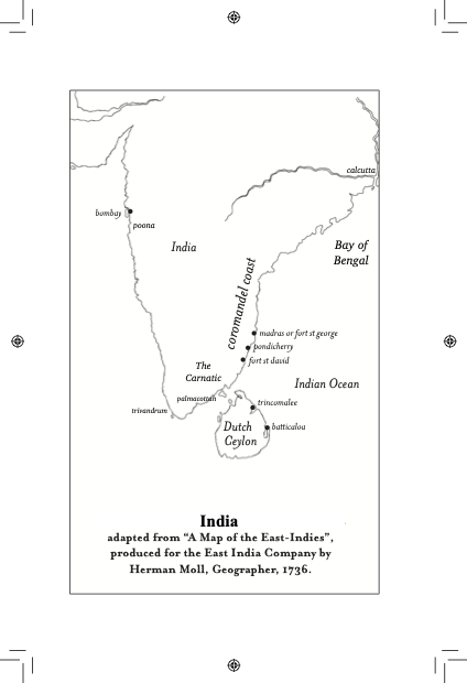
Calcutta: Home to the Boyd and Hunter families
Poona: Sarah and James Welsh were stationed at Poona in 1805
Palmacottah: William Light travelled with James Welsh to his new posting here
Trivandrum: Sarah Light Welsh and the children lived here during this time
Part Three: The Iberian Peninsula
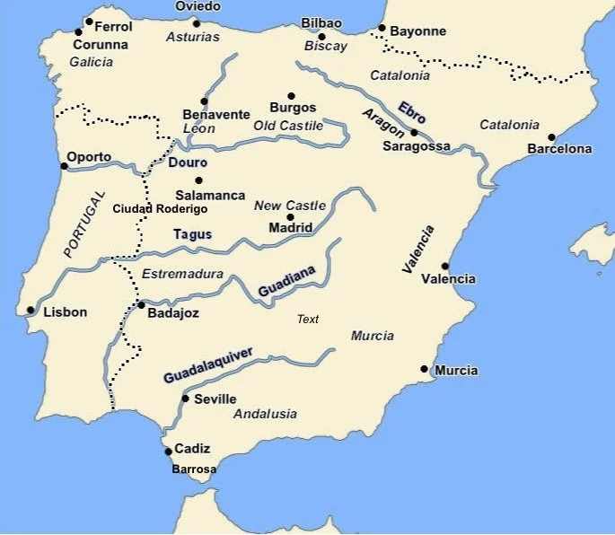
William Light distinguished himself at some of the major battles of the Peninsular War against Napoleonic France (1808-1814), namely Talavera, Ciudad Rodrigo, Badajoz, Villagarcia (Seville) and Salamanca. He was attached to th per5sonal staff of General Sir Arthur Wellesley, later Duke of Wellington, although most of his war years were spent as a scout and liaison officer with the Portuguese forces and Spanish guerrillistas. He was fluent in both languages – as well as French – and was often mentioned in dispatches for his courage and daring.
For more details on the Peninsular War see British Battles/Peninsular War
Part Four: Java
Map courtesy of Monsoon Books. Many thanks to Philip Tatham and Tim Hannigan
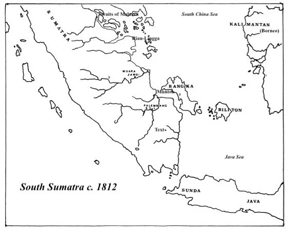
In 1811, as a consequence of the Napoleonic Wars in Europe and the French occupation of the Kingdom of the Netherlands, a British East India company army was dispatched to wrest the Dutch East Indies from French control. Francis Lanoon Light accompanied this Java expeditionary force led by Governor-General Lord Minto and Thomas Stamford Raffles who was later installed as Lieutenant Governor of Java. In 1812, Lanoon was appointed Resident at Muntok on Bangka Island (off Sumatra). Bangka and Belitung (Biliton to the British) were valuable sources of tin.
Map: sabrizain.org
Part Five: Britain and Ireland
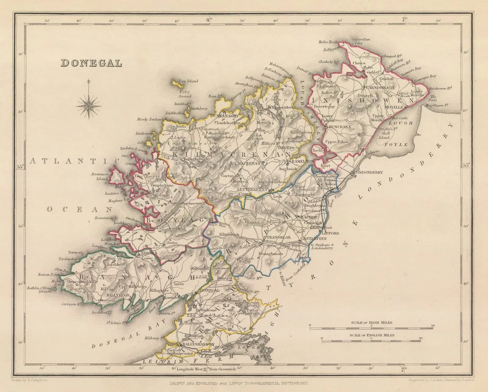
In the aftermath of the Napoleonic Wars, when commissions were scarce, many returning soldiers were sent to Ireland, particularly Ulster in the North, always regarded as a particularly contentious region with a history of rebellion, most recently with French assistance. Captain William Light spent several years based in Letterkenny on the southern end of Lough Swilly where he supervised regular sweeps along a series of forts and Martello towers on the lough which had been erected following the 1798 Wolf Tone Rebellion.
Map of Donegal by Samuel Lewis 1850
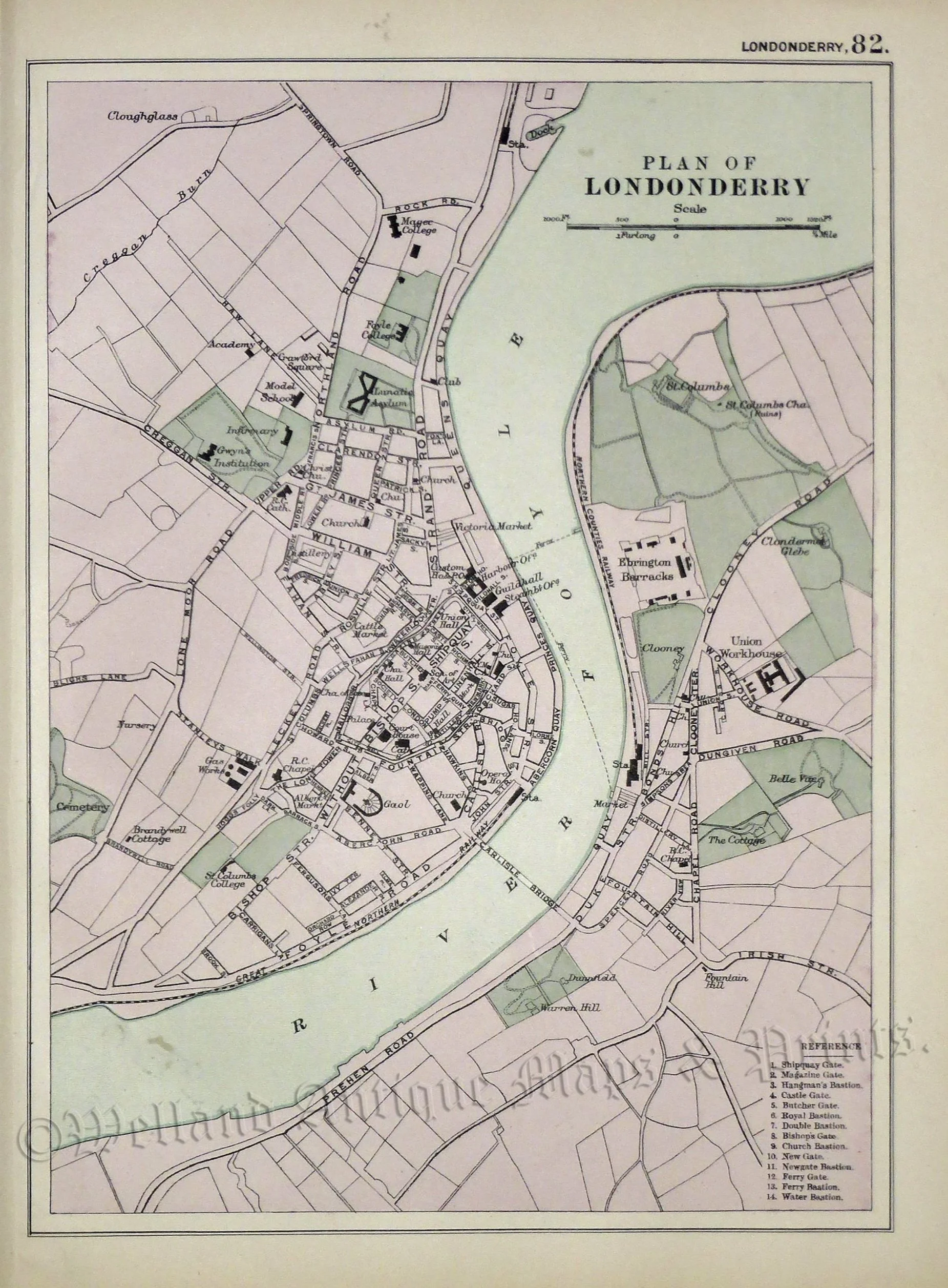
Map of Londonderry c 1895 by F. W. Bacon
[www.wellandantiquemaps.uk]
Part Six: The Grand Tour
The 1820s saw the resumption of the tradition of ‘The Grand Tour’ where young men and women of means spent time travelling Europe for their health, education and enlightenment. After the war, as prices in Britain soared and opportunities for many were scarce now that peace had ended commission, it became cheaper to live in Europe than at home.
Following his marriage in 1824 to Miss Mary Bennet, William and his new bride spent most of the next six years travelling through France, Italy, Switzerland and the Greek islands, visiting the antiquities, sketching and painting, keeping journals of their travels, and socialising with the ‘in crowd’ of the day. William even purchased his own yacht, the Gulnare which he sailed around the Mediterranean, the Adriatic and the Aegean.

Europe circa 1835
Map courtesy of Time Maps
Part Seven: Egypt

William and Mary Light lived in Alexandria for several years during which time they travelled extensively up the Nile as far as the First Cataract, visiting the ancient sites and sketching. Whilst in Egypt, William Light took service with Pasha Mehmet (Muhammad) Ali to assist in building up a modern Egyptian navy, even visiting him in his new palace on the outskirts of Cairo at Shubra. Mary is even reported to have made journeys alone along the Nile in William’s absence, often dressing in male clothing.
[Map courtesy of Planet Archaeology]
Part Eight: South Australia

Map by the famous cartographer John Tallis. First published 1851.
The crowning achievement of William Light’s life was in founding and laying out the city of Adelaide in South Australia even now known for its open wide spaces, greenery and excellent urban planning. Much of this resulted from Light’s original vision and his discovery of an inland sheltered port on the river Torrens which protected shipping from the fierce currents of the Great Australian Bight.
In an extraordinarily short time of less than three years from his first arrival, tens of thousands of town and city acres were surveyed and prepared for occupation to house the many migrants on assisted passages who had already been sent by the South Australian Commission.
The enormous workload and the stress of the opposition he faced from other administrators, placed a great toll on Light’s health, which was already weakened by tuberculosis. Colonel William Light died in October 1839 at the comparatively young age of 53.